


Redditch Walks is part of my Explore Redditch group of websites Designed, maintained and administered by Anthony Green
Countryside Code
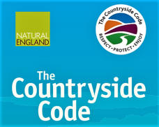
The basic advice for walking in the countryside, or anywhere, is given in the Countryside Code. Based on the criteria Respect - Protect - Enjoy, the main section headings are: Advice for the public: introduction Be safe - plan ahead and follow any signs Leave gates and property as you find them Protect plants and animals, and take your litter home Keep dogs under close control Consider other people The code can be read in full at the Natural England web site.Ramblers Association
For walking in general, there is no better source than the Ramblers Association. The Ramblers was founded in 1935 and, as a charity working to promote walking and to improve conditions for all walkers, is Britain's biggest . It has over 135,000 members in England, Scotland and Wales. On their web site you will find useful information on walking in Britain.
Other Walks
Please note that these are given on an ‘as-is’ basis and may not be up tp date.Archived RedditchWalks
I have decided to concentrate on the Redditch Town and Arrow Valley history walks. I will not therefore be updating other walks I have developed. Most were last updated in 2010. These are available on as ‘as is’’ not updated basis. The walks are the following…. • Local Area Walk Beoley • Local Area Walk Tardebigge • Local District Walk Church Hill • Local District Walk Church hill to BeoleyDevelopment Corporation
In the early days of the Redditch Development Corporation they produced a document showing short walks of between 2 and 3 miles around the town and local area. These are produced here in their original form, date from the 1970s and some areas have changed significantly since that time.. (please note that these are scanned from the original as PDFs and are quite large (1.5 to 2 Mb) • walk 1 - Woodrow Centre to Town Centre • walk 2 - Arrow Valley Park North • walk 3 - Ipsley and Matchborough • walk 4 - Woodrow Centre to StudleyRedditch Borough Council
There are a number of circular walks which were provided by the the Redditch Borough Council. These start and finish at the Arrow Valley Country Park. They are not necessarily updated. • Woodland Trail: ½ mile walk through woodland. • Meadows Trail: 1½ trail through meadowland • Lakeside Trail: a 1 mile walk around the Arrow Valley lake. • Millers Trail: a 2 mile route along the River Arrow to the Forge Mill Needle Museum.
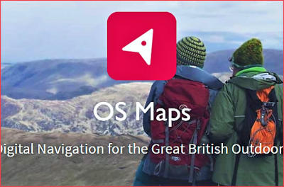
Ordnance Survey Maps
At Ordnance Survey you can buy maps and outdoor gear – everything you need to explore, boost your fitness and stay safe. There is also a good value on-line mapping resource and also, delivered by Ordnance Survey (OS), there is free map containing data from OS and other sources, through the leisure mapping app and online service. This comprehensive map of Great Britain’s greenspaces is also available as an open dataset, called OS Open Greenspace, for communities, businesses and developers to create products and services that will encourage healthier and greener lifestyles. https://www.ordnancesurvey.co.ukOpen Street Map
OpenStreetMap is built by a community of mappers that contribute and maintain data about roads, trails, cafés, railway stations, and much more, all over the world. OpenStreetMap is open data: you are free to use it for any purpose as long as you credit OpenStreetMap and its contributors. If you alter or build upon the data in certain ways, you may distribute the result only under the same licence. https://www.openstreetmap.org/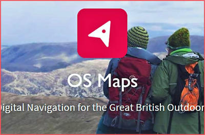


Redditch Walks is part of my Explore Redditch group of websites
Designed, maintained and administered by Anthony Green
Countryside Code
The basic advice for walking in the countryside, or anywhere, is given in the Countryside Code. Based on the criteria Respect - Protect - Enjoy, the main section headings are: Advice for the public: introduction Be safe - plan ahead and follow any signs Leave gates and property as you find them Protect plants and animals, and take your litter home Keep dogs under close control Consider other people The code can be read in full at the Natural England web site.Ramblers Association
For walking in general, there is no better source than the Ramblers Association. The Ramblers was founded in 1935 and, as a charity working to promote walking and to improve conditions for all walkers, is Britain's biggest . It has over 135,000 members in England, Scotland and Wales. On their web site you will find useful information on walking in Britain.
Other Walks
Please note that these are given on an ‘as-is’ basis and may not be up tp date.Archived RedditchWalks
I have decided to concentrate on the Redditch Town and Arrow Valley history walks. I will not therefore be updating other walks I have developed. Most were last updated in 2010. These are available on as ‘as is’’ not updated basis. The walks are the following…. • Local Area Walk Beoley • Local Area Walk Tardebigge • Local District Walk Church Hill • Local District Walk Church hill to BeoleyDevelopment Corporation
In the early days of the Redditch Development Corporation they produced a document showing short walks of between 2 and 3 miles around the town and local area. These are produced here in their original form, date from the 1970s and some areas have changed significantly since that time.. (please note that these are scanned from the original as PDFs and are quite large (1.5 to 2 Mb) • walk 1 - Woodrow Centre to Town Centre • walk 2 - Arrow Valley Park North • walk 3 - Ipsley and Matchborough • walk 4 - Woodrow Centre to StudleyRedditch Borough Council
There are a number of circular walks which were provided by the the Redditch Borough Council. These start and finish at the Arrow Valley Country Park. They are not necessarily updated. • Woodland Trail: ½ mile walk through woodland. • Meadows Trail: 1½ trail through meadowland • Lakeside Trail: a 1 mile walk around the Arrow Valley lake. • Millers Trail: a 2 mile route along the River Arrow to the Forge Mill Needle Museum.
Ordnance Survey Maps
At Ordnance Survey you can buy maps and outdoor gear – everything you need to explore, boost your fitness and stay safe. There is also a good value on-line mapping resource and also, delivered by Ordnance Survey (OS), there is free map containing data from OS and other sources, through the leisure mapping app and online service. This comprehensive map of Great Britain’s greenspaces is also available as an open dataset, called OS Open Greenspace, for communities, businesses and developers to create products and services that will encourage healthier and greener lifestyles. https://www.ordnancesurvey.co.ukOpen Street Map
OpenStreetMap is built by a community of mappers that contribute and maintain data about roads, trails, cafés, railway stations, and much more, all over the world. OpenStreetMap is open data: you are free to use it for any purpose as long as you credit OpenStreetMap and its contributors. If you alter or build upon the data in certain ways, you may distribute the result only under the same licence. https://www.openstreetmap.org/