

Site Designed, administered and published by Anthony Green

Loading...
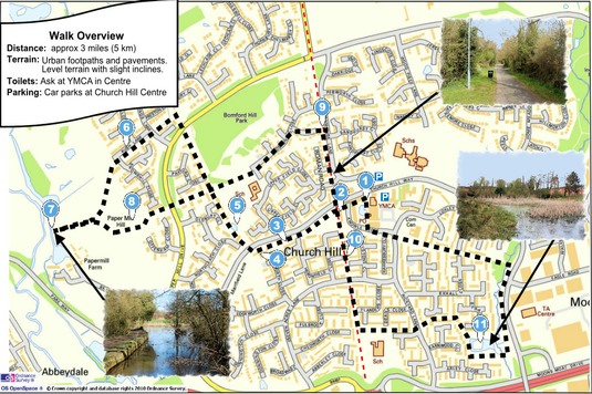
The walks begin at Church Hill Centre
There is a Car Park at the Church Hill Centre (use Google Map below).
This 3 mile (approx) walk follows urban footpaths and pavements and includes examples of marl pits, the route of a Roman Road and the site of a 16th century hunting lodge.
The route is generally of level terrain with some slight inclines.
Please click on this map to download the trifold A4 map.
This is in pdf format and can be printed using Adobe Reader or similar.
There are also three shorter walks based on this walk which have been produced in association with the Church Hill Big Local organisation.
You can download these in pdf format from the following links…